란도너스 퍼머넌트 PT-94 낙동정맥 어드벤처 / Nakdong Mountain Adventure GPX 코스파일
설명
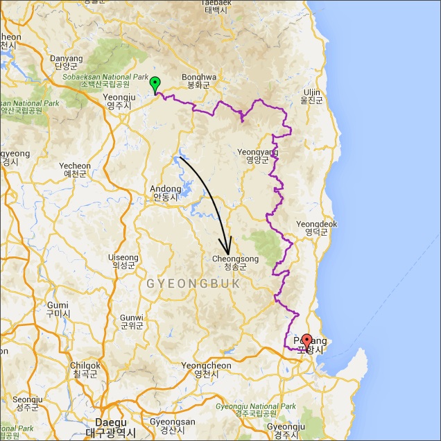 거리: 253km
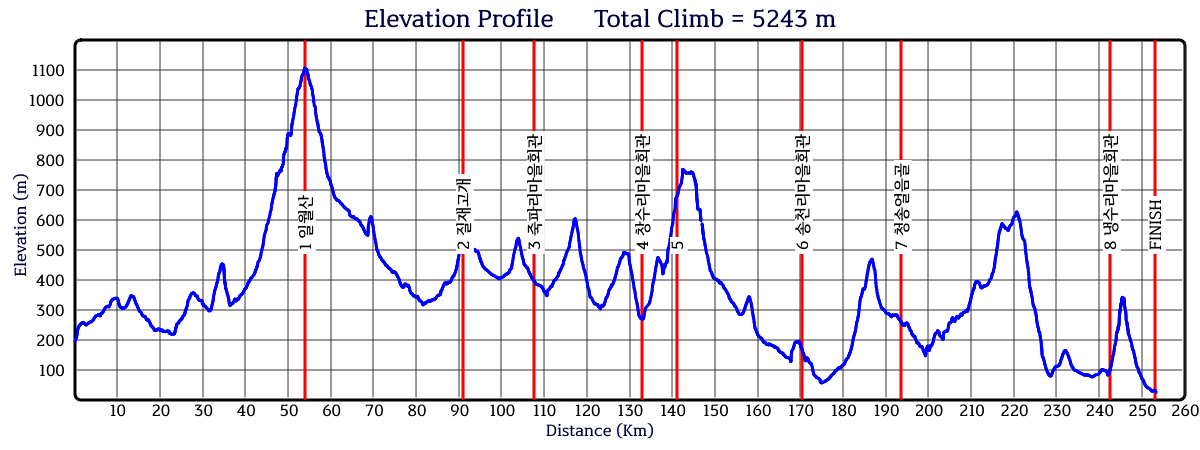
상승고도: 5,243m
제한시간: 16:52
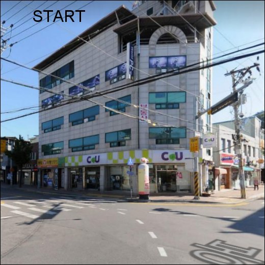
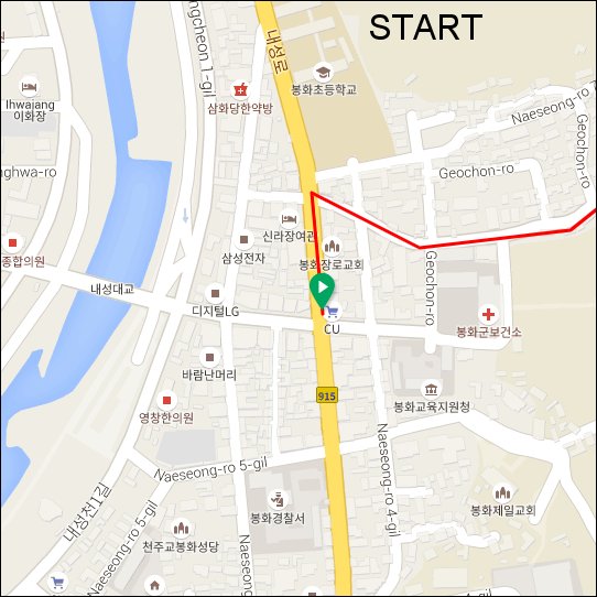
출발점: 봉화
도착점: 포항
코스설계자: 원광식
Last Update : 2020.11.20
https://drive.google.com/drive/folders/1Ai9bYrUZmi9AmyIxVkCSCKynlVVgk1KI?usp=sharing
이 퍼머넌트는 "어드벤처 시리즈" 중 하나입니다. 어드벤처 퍼머넌트는 험난하고, 오지의 작은 길을 달리며 한국의 가장 아름다운 경치를 보여줍니다. 참가자들은 좋은 컨디션과 완벽한 준비가 필요합니다. 항상 조심해야 합니다. 만약 날씨가 좋지 않다면 진행이 어려울 수 있습니다. 눈이 녹지 않았거나, 비가 오거나, 비가 온 직후에는 위험합니다. 도로 위의 낙석과 모래, 낙엽 등을 조심하세요. 반드시 클릿커버 또는 여분의 신발 등을 준비하세요. 림-브레이크용 카본 휠셋은 사용하지 않는 것이 좋습니다. 어드벤처 시리즈는 24개 이상의 퍼머넌트가 있습니다. 어드벤처 시리즈 중에서 각기 다른 퍼머넌트를 완주하면 세 가지 상을 받을 수 있습니다: 어드벤처-6, 어드벤처-12, 어드벤처-24 어워드. 완주기간 제한은 없습니다. 수상자는 한국 란도너스의 수상 명단에 등록되며, Adv-24 수상자에게는 기념메달이 무료로 발송됩니다. 어드벤처 퍼머넌트는 웹사이트의 "명예 및 수상 - 수상 종목" 에서 확인하세요.
This permanent is one in the "adventure series". Permanents in the adventure series are hard, using small roads in remote countryside and show the most beautiful scenery of the country. Riders must have a good condition and must be well prepared. Take care of safety at all time. If the weather condition is not good, especially after rain or snow, riding can be difficult. Please be careful of small pebbles, sand, and fallen leaves on the road. Be sure to prepare cleat-covers, etc. Carbon wheelsets with rim-breaks are not recommended. There are over 24 different adventure permanents. Three awards can be won for completing different adventure permanents at own choice: Adventure-6 award, Adventure-12 award and the Adventure-24 award. There is no date limit. The winners are listed in the 'Honor Roll' on the Korea Randonneurs website. The winner of the Adv-24 award will receive a medal (no cost).
To see a list of all adventure permanents, please visit the section AWARDS in this website.
This is a permanent for those of you who want to take a little bit of adventure for beautiful views and enjoy a journey to the outback, where few cars go. Starting from Bonghwa, the road from the Ilwol Tunnel to Ilwolsan Mountain has long been covered with bushes, but the adventurous randonneurs can climb well. (Prepare spare tires and tubes.) After climbing to the top of Ilwolsan Mountain, enjoy the downhill of Oesibersun-gil, where Chunyangmok is tall, and Wangsukpocheon the upper reaches of Wangpicheon. If you come in the fall, you will be greeted with wonderful fallen leaves. On the Subimeon, you will use Local Road No. 917. It is a representative local road that passes through the Nakdong Mt and is not paved with some sections, so you should be careful when downloading. After acrossing Ultijae, the old road of Changsuryoung, you will enter Mangdong mountain wind power complex. It is one of the ways to enjoy this permanent by greeting sunrise and sunset at Mt.Mangdong according to the starting time at Bonghwa. Haok Valley, which pass through the Cheongsong Ice Valley, provides cool wind in summer and nice leaves in autumn. After that, finish the Nakdong Mountain Adventure with a bowl of fresh mulhoe (물회) in Pohang.
거리: 253km
상승고도: 5,243m
제한시간: 16:52
출발점: 봉화
도착점: 포항
코스설계자: 원광식
Last Update : 2020.11.20
https://drive.google.com/drive/folders/1Ai9bYrUZmi9AmyIxVkCSCKynlVVgk1KI?usp=sharing
이 퍼머넌트는 "어드벤처 시리즈" 중 하나입니다. 어드벤처 퍼머넌트는 험난하고, 오지의 작은 길을 달리며 한국의 가장 아름다운 경치를 보여줍니다. 참가자들은 좋은 컨디션과 완벽한 준비가 필요합니다. 항상 조심해야 합니다. 만약 날씨가 좋지 않다면 진행이 어려울 수 있습니다. 눈이 녹지 않았거나, 비가 오거나, 비가 온 직후에는 위험합니다. 도로 위의 낙석과 모래, 낙엽 등을 조심하세요. 반드시 클릿커버 또는 여분의 신발 등을 준비하세요. 림-브레이크용 카본 휠셋은 사용하지 않는 것이 좋습니다. 어드벤처 시리즈는 24개 이상의 퍼머넌트가 있습니다. 어드벤처 시리즈 중에서 각기 다른 퍼머넌트를 완주하면 세 가지 상을 받을 수 있습니다: 어드벤처-6, 어드벤처-12, 어드벤처-24 어워드. 완주기간 제한은 없습니다. 수상자는 한국 란도너스의 수상 명단에 등록되며, Adv-24 수상자에게는 기념메달이 무료로 발송됩니다. 어드벤처 퍼머넌트는 웹사이트의 "명예 및 수상 - 수상 종목" 에서 확인하세요.
This permanent is one in the "adventure series". Permanents in the adventure series are hard, using small roads in remote countryside and show the most beautiful scenery of the country. Riders must have a good condition and must be well prepared. Take care of safety at all time. If the weather condition is not good, especially after rain or snow, riding can be difficult. Please be careful of small pebbles, sand, and fallen leaves on the road. Be sure to prepare cleat-covers, etc. Carbon wheelsets with rim-breaks are not recommended. There are over 24 different adventure permanents. Three awards can be won for completing different adventure permanents at own choice: Adventure-6 award, Adventure-12 award and the Adventure-24 award. There is no date limit. The winners are listed in the 'Honor Roll' on the Korea Randonneurs website. The winner of the Adv-24 award will receive a medal (no cost).
To see a list of all adventure permanents, please visit the section AWARDS in this website.
This is a permanent for those of you who want to take a little bit of adventure for beautiful views and enjoy a journey to the outback, where few cars go. Starting from Bonghwa, the road from the Ilwol Tunnel to Ilwolsan Mountain has long been covered with bushes, but the adventurous randonneurs can climb well. (Prepare spare tires and tubes.) After climbing to the top of Ilwolsan Mountain, enjoy the downhill of Oesibersun-gil, where Chunyangmok is tall, and Wangsukpocheon the upper reaches of Wangpicheon. If you come in the fall, you will be greeted with wonderful fallen leaves. On the Subimeon, you will use Local Road No. 917. It is a representative local road that passes through the Nakdong Mt and is not paved with some sections, so you should be careful when downloading. After acrossing Ultijae, the old road of Changsuryoung, you will enter Mangdong mountain wind power complex. It is one of the ways to enjoy this permanent by greeting sunrise and sunset at Mt.Mangdong according to the starting time at Bonghwa. Haok Valley, which pass through the Cheongsong Ice Valley, provides cool wind in summer and nice leaves in autumn. After that, finish the Nakdong Mountain Adventure with a bowl of fresh mulhoe (물회) in Pohang.
출발지
봉화
도로 유형
• 도로 유형
• 도로 노면 상태
도로 유형을 분석하고 있습니다
다운로드
댓글
0
kakao
 세그먼트
세그먼트
웨이포인트
마커 숨김
ESC 키를 누르면 전체화면이 종료됩니다.
카카오맵
지도
위성
세그먼트
3% 이상
500m 이상
-
사질고개 북측 #령재치0.78km / 43m
-
TT7.93km / 8m
-
공이재2.42km
-
재산면 갈산리 산253 1 Climb1.40km / 87m
-
Segment0.68km / 86m
-
일월산 (낙동어드벤쳐 KORA)17.20km / 1059m
-
일월재 임도구간 업힐3.36km / 204m
-
일월재 adv. ⛰3.35km / 202m
-
일월재 삼거리 to 정상까지 ⛰3.14km / 223m
-
낙엽송길 힐링 adv. ⛰7.78km / 35m
-
Segment0.78km / 98m
-
왜무랑재 북측 #령재치0.63km
-
질재2.13km
-
unnamed hill1.36km / 129m
-
북수교_기포령7.28km / 496m
-
기포령(임도삼거리→정상)2.52km / 190m
-
R.P. Offroad3.96km / 102m
-
무창삼거리~창수령(업힐)5.74km
-
창수령 북측 #령재치5.91km / 354m
-
영양군 풍력발전소3.90km / 367m
-
선들재(황장리방향)1.58km / 72m
-
양설령 북측 #령재치5.60km / 545m
-
봉산저수지~ 주산재 업힐3.34km / 250m
-
달산면 봉산리 567 2 Climb0.99km / 89m
-
양설령4.72km
-
부동면 내룡리 산1 1 Climb0.93km / 178m
-
주산재~봉산재 업힐1.13km / 79m
-
옥계→상옥통제초소12.20km / 709m
-
옥계계곡 어드벤쳐 #령재치12.20km / 412m
-
양장고개 북측 #령재치0.77km / 54m
-
뒷머리재 북측 #령재치2.23km / 122m
-
상옥 ~ 수목원7.29km
-
[PRBC] 수목원 상옥업힐5.60km / 249m
-
샘재(경북수목원) 북측 #령재치2.38km / 87m
-
서정삼거리→신광 (by YJ)8.55km
-
육재(마을다리에서시작) 출발 지점 300m0.31km / 4m
-
엿재 북측 #령재치0.97km / 63m
-
육재(마을다리에서시작) 도착 지점 300m0.31km / 24m
-
만석교→도음산삼거리8.50km / 61m
-
[[진짜]]갑을교→도음산 입구 삼거리3.26km / 34m
-
냉수리입구>풍발정자삼거리3.11km / 256m
-
도음산 역업힐3.28km / 263m
-
도음산 업힐(냉수1리마을회관 출발)2.90km / 251m
-
(역)도음산 본격업힐2.63km / 235m
웨이포인트